
New research has revealed that more than 12 per cent of Carlisle homes are at risk of flooding.
The data is based on information from the Environment Agency that estimates flood risk for homes, and uses historic flood data.
It has been narrowed down to a county, local authority and constituency level.
The analysis also reveals whether the local MPs in a given county have voted in favour or against legislation to combat climate change.
Data for Cumbria shows that one MP voted for legislation against combatting climate change and another voted against.
However, the information for the four remaining MPs was not disclosed.
The map also shows the percentage of properties at risk of flooding and those at high risk of flooding.
In Carlisle:
- 0.48 per cent are at high risk
- 12.38 per cent are at risk
In Allerdale:
- 0.71 per cent are at high risk
- 6.93 per cent are at risk
In Penrith and the Borders:
- 1.24 per cent are at high risk
- 6.52 per cent are at risk
In Copeland:
- 0.61 per cent are at high risk
- 8.73 per cent are at risk
In Westmorland and Lonsdale:
- 3.26 per cent are at high risk
- 12.07 are at risk
In Barrow:
- 1.57 per cent are at high risk
- 7.38 per cent at risk
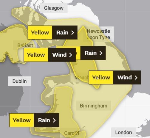
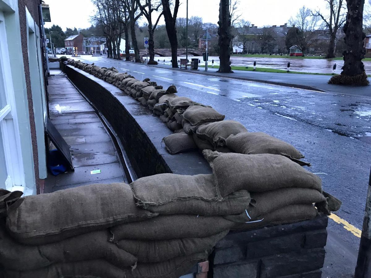
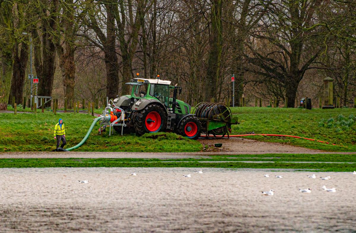
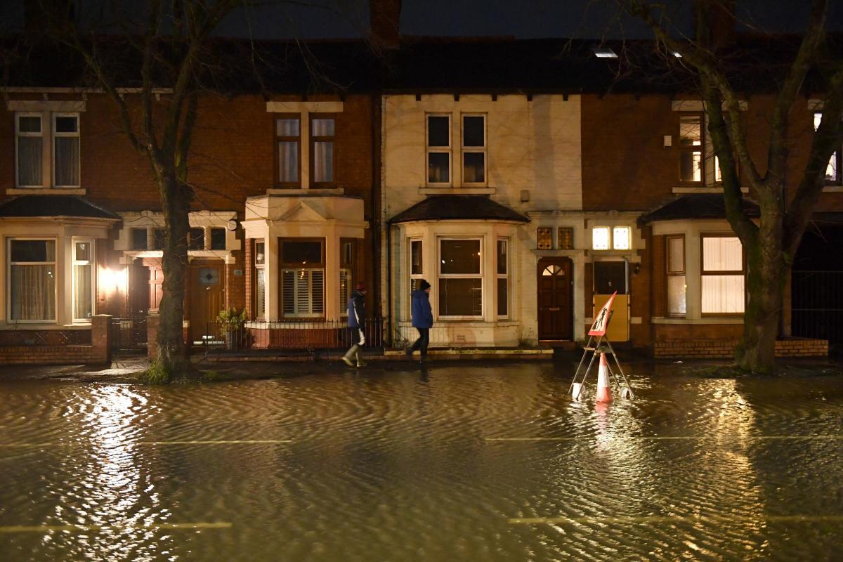
The revelations come as Cumbria braced itself for Storm Jorge having already suffered at the hands of storms Ciara and Dennis.


Comments: Our rules
We want our comments to be a lively and valuable part of our community - a place where readers can debate and engage with the most important local issues. The ability to comment on our stories is a privilege, not a right, however, and that privilege may be withdrawn if it is abused or misused.
Please report any comments that break our rules.
Read the rules here